
| Home | Exploration Geochemistry Services | Environmental Geochemistry Services |
©2002 Exploration Technologies, Inc.
|
|
| Assessment and Remediation of Hydrocarbon Contamination in a Latin American Petroleum Facility | |
|
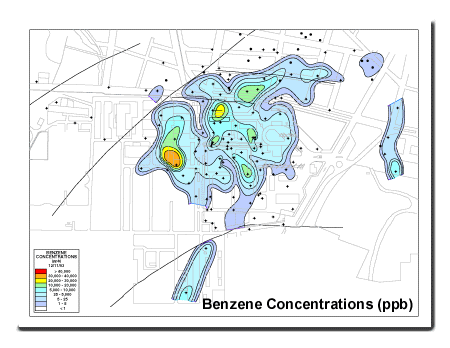
During the paving of a residential street in an area adjacent to a very large petroleum complex in Latin America, gasoline contamination was detected within three feet of the surface. A geochemical soil gas survey established the horizontal extent of the contamination. To locate monitor wells and recovery systems, concentrations of C1-C5+ soil gases were mapped and integrated with the local subsurface geology to identify pathways defined by high concentrations of light gases and contaminants. Based on the soil gas results, 104 monitor wells were installed; 82 had significant concentrations of contaminants, with 63 having up to 2 ft of liquid hydrocarbons on the ground water. Interceptor/recovery trenches, totaling 1600 feet in length and located on the basis of the soil gas survey (over 5,000 soil gas samples were collected), soil analyses and ground water analyses, recovered over 1,300 barrels of hydrocarbon products in less than one year. |
|
|
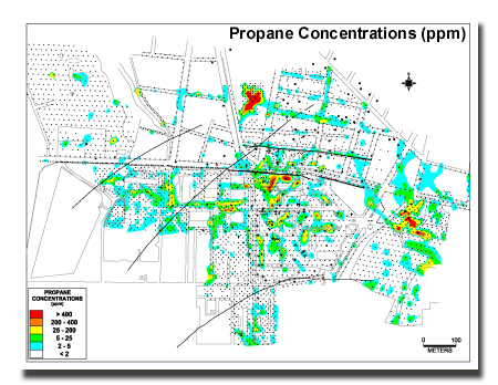
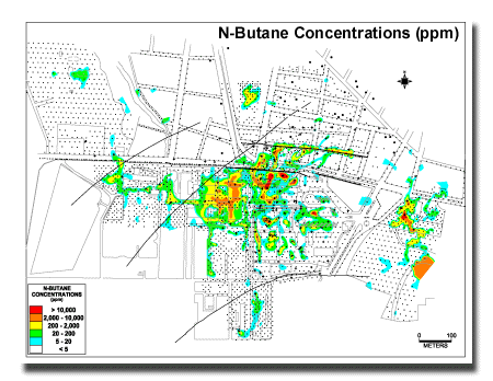
| Light Hydrocarbon analyses (C1-C4) measure the lightest, most volatile constituents present in gasolines and other petroleum products. Methane, ethane, propane and butanes are present in varying concentrations in many refined petroleum products. These light hydrocarbon compounds tend to dissipate more rapidly with time and/or distance from the point(s) at which petroleum constituents are introduced into the subsurface environment. Light hydrocarbon analyses allow for the identification and differentiation of natural gas, natural biogenic methane, "gasoline type" and other refined petroleum product constituents. | |
|
|
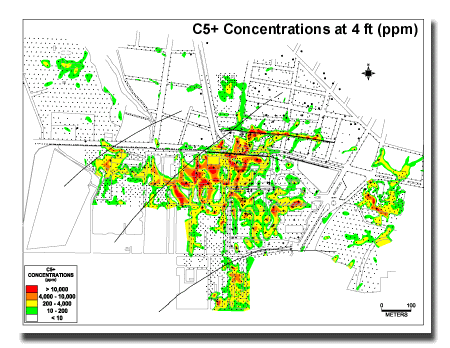
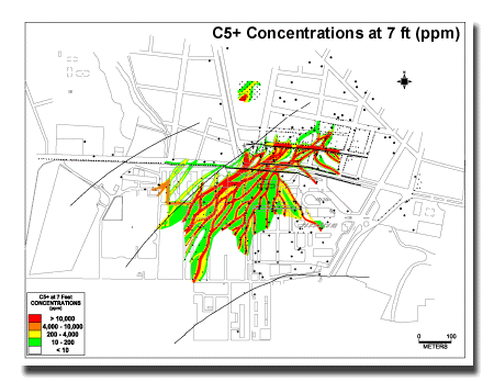
| C5+ (gasoline range) hydrocarbon analyses yield a quantitative measure of the actual concentration, by volume, of gasoline type vapors present in near surface soils. Gasoline range hydrocarbons dissipate more slowly than lighter fraction (C1-C4) compounds. | |
|
|
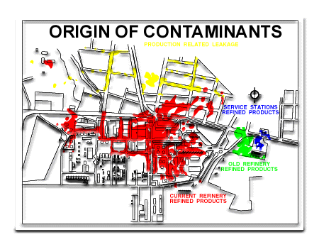
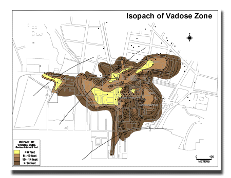
| Numerous contaminated areas were discovered, containing approximately 13 different products, (gasolines, diesel, oils, crudes) that leaked into the subsurface over a 60 year period with the product reservoirs and migration pathways controlled by recent environments of deposition. Contaminant reservoirs are vadose zone clayey silts and fine sands 4-10 feet deep, and migration is along either old braided stream floodplain channels or old alluvial fan channels entering the floodplain. Man-made utilities trenches also modify the migration routes of the contaminants. | |
|
|
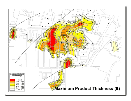
| The maximum product thickness map provides the most accurate representation of the location of contamination in the subsurface. Remediation trenches were designed to intersect geologic channels which focussed product migration and accumulation. Subsequent to initial product recovery trenches act as barriers to further migration of contamination into inhabited areas. | |
| | Home | Exploration Geochemistry Services | Environmental Geochemistry Services | ©2002 Exploration Technologies, Inc. |
|